Drone land surveying, just like traditional land surveying, is the practice of measuring 3D points on land areas for evaluation. The difference is that drone surveying employs unmanned aerial vehicles, or UAVs for short.
Drone surveys are an excellent asset in the fields of engineering and construction with their ability to rapidly produce highly accurate point clouds, orthophotography, and digital models of land areas.
Being a forward-focused civil engineering company, we are always seeking to offer solutions that enhance our results and provide added value. Our data collection services aid in land development, construction projects, archaeology, forest and agriculture management, and so much more.
In this article, we will give you an overview of what drone land surveying is, the data and maps it can produce, and its advantages and disadvantages.
What is Drone Land Surveying
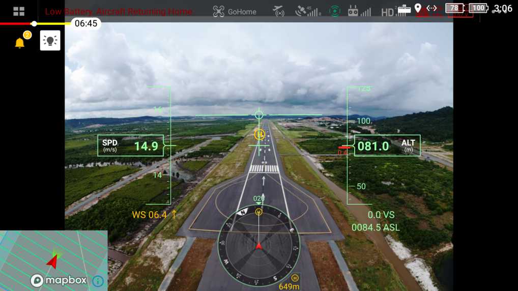
Drone surveying, also known as drone mapping or remote sensing, is the process of surveying an area with an unmanned aerial vehicle and downward-facing sensors to obtain geospatial data. We offer two drone surveying methods, photogrammetry and lidar. Each method has its own ideal usage.
Photogrammetry: Uses overlapping images and positioning data to reconstruct the terrain into 2D or 3D models. This method relies heavily on visibility. Great for fast surveys and visualization of areas but struggles to gather terrain data beneath vegetation.
LiDAR: Light detection and ranging devices measure features by pulsing light beams and calculating the reflection properties. The LiDAR data generates a point cloud which is combined with positioning data to obtain highly accurate X, Y, and Z coordinate data for each point. Great for high-accuracy surveying needs and is capable of penetrating heavy vegetation.
Advanced data processing is required for both methods. Processes such as geo-referencing the dataset, correcting distortions, ensuring alignments, and quality control take place before producing the final terrain model.
Types of Drone Mapping Data
Numerous calculations and measurements (volume, distances, elevation, and more) can be performed following the data processing phase of a drone land surveying mission.
Orthomosaic Maps
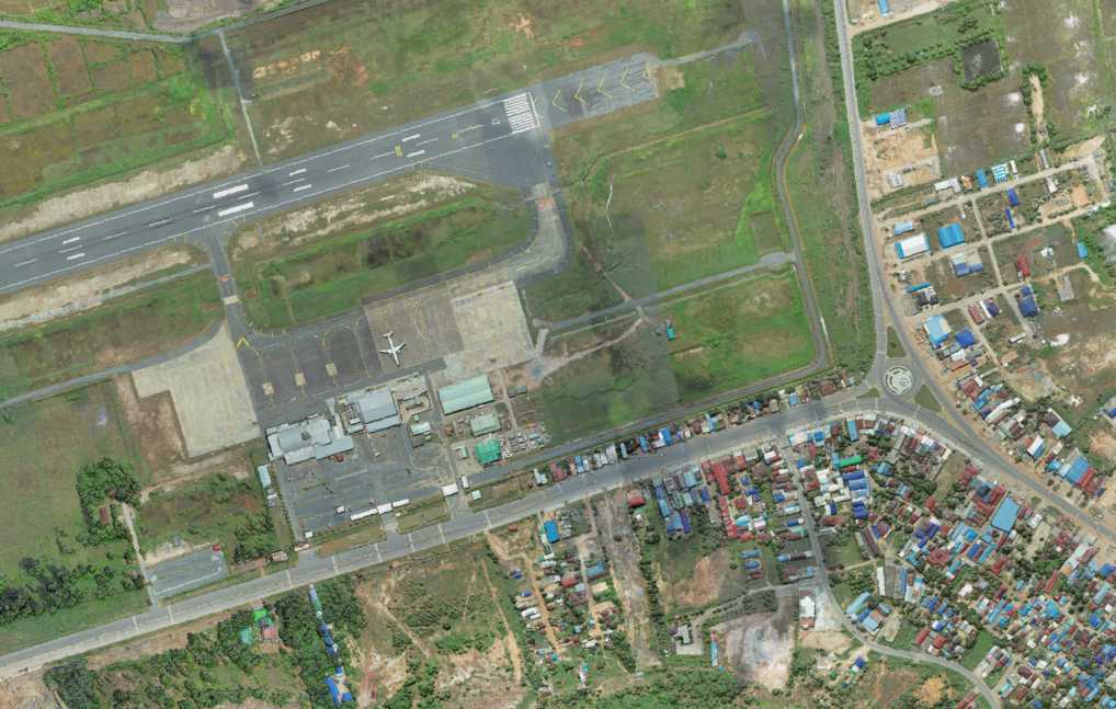
Orthomosaic maps are the stitched together and geo-referenced photos taken during a drone survey. The result produces a land map like the satellite view of Google Maps. The orthomosaic is much more accurate and is capable of producing centimeter accuracy.
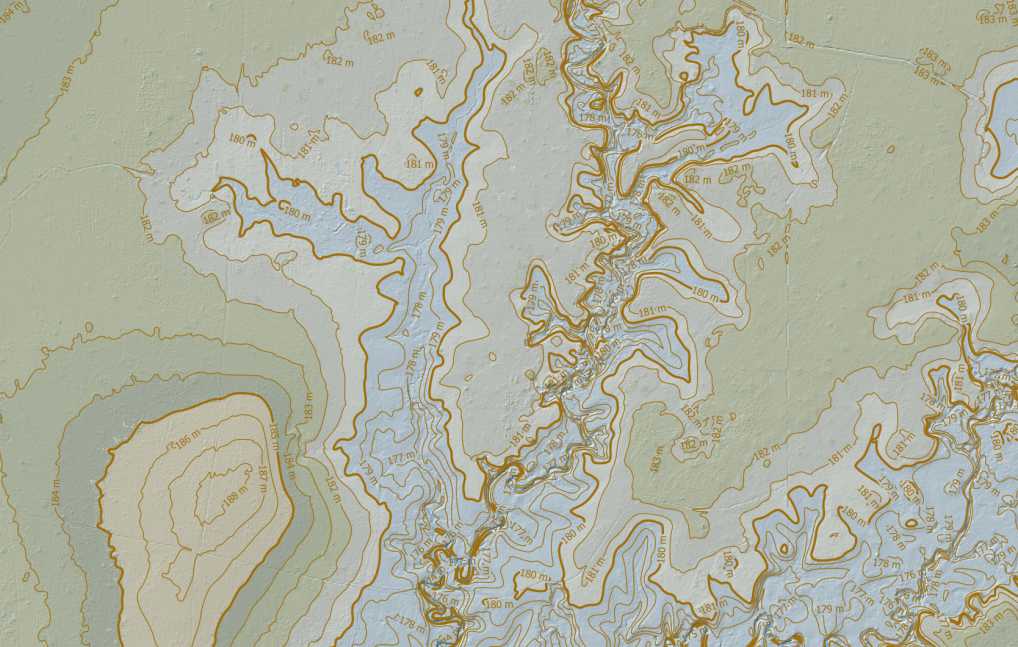
3D Models
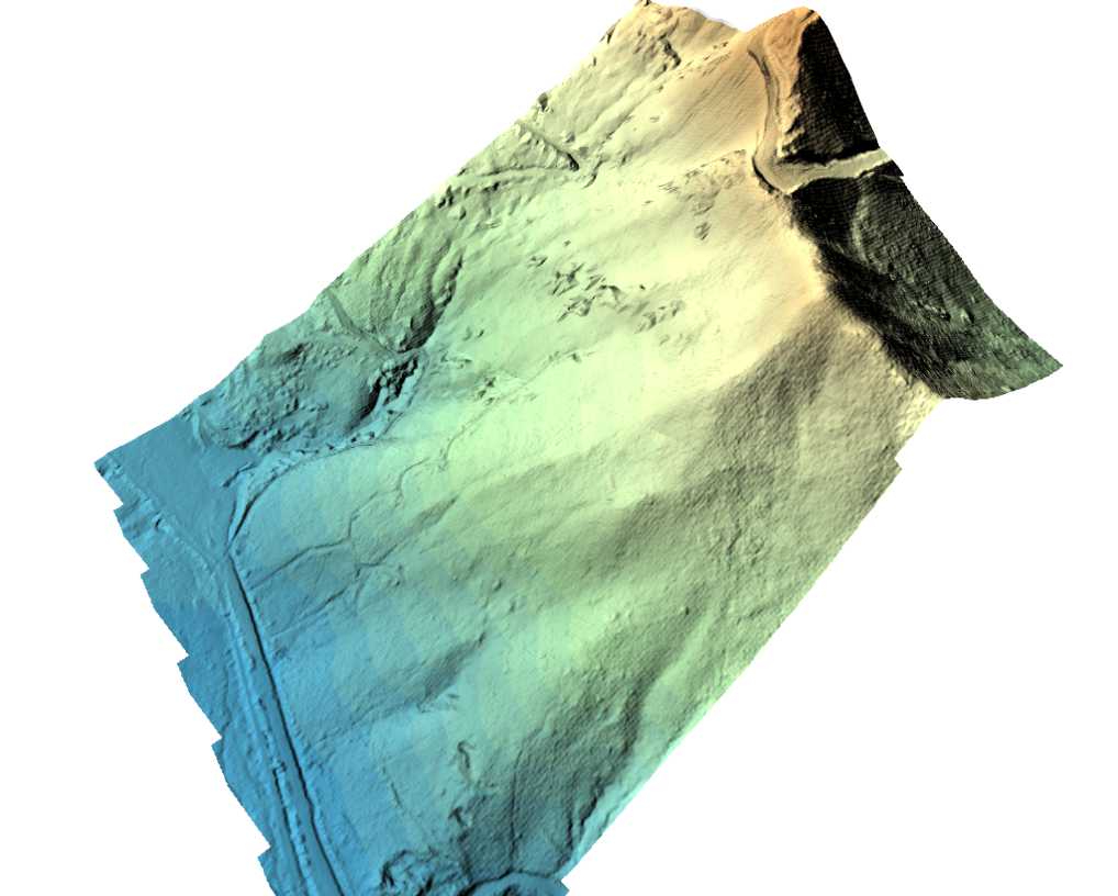
3D models of specific features (buildings, statues, etc.) can be produced when the survey mission is conducted in a manner to collect data on all faces. The more commonly-used 3D models represent the land and its features in different ways.
- Digital Surface Model – DSM: Elevation model that represents the terrain and all above-ground features such as trees, buildings, and other structures.
- Digital Elevation Model – DEM: Elevation model that represents the terrain by removing any natural or man-made structures that are above ground.
- Digital Terrain Model – DTM: An augmented version of a DEM that combines the terrain data with linear features such as contour lines, breaklines, and others.
LiDAR Data and Point Clouds
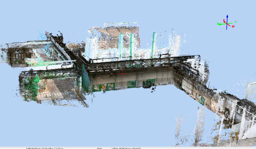
LiDAR drone surveys collect data by measuring individual light beam properties. This data produces a high-density point cloud. The point cloud is a set of data points in space, each with a set coordinate on the X, Y, and Z axis.
Photogrammetric survey data can also produce point clouds. However, the result is not as accurate or as flexible as with LiDAR.
Why Choose Drone Land Surveying and Mapping
Employing drones for land surveying is practical and cost-effective. Drones increase survey capacity, provide clear site visualizations, and produce valuable results. Drone land surveying does have its limitations, particularly when it comes to weather conditions.
Advantages of Drone Surveying
- Drone surveying is faster than traditional surveying methods. Drones can cover large land areas in single flights and collect data rapidly.
- Drone surveying is safer than on-the-ground surveying. This is valid for both remote and urban areas. There is no need for teams to traverse hazardous areas or dangerous roadways on foot.
- Drone mapping is highly accurate when using the proper survey-grade equipment and methods.
- Drone mapping of large land areas is cost-efficient compared to other aerial (plane and helicopter) and traditional surveying methods.
Disadvantages of Drone Surveying
- Not just anyone with a drone can conduct a drone land survey. Surveying must be conducted by professional drone pilots and surveyors.
- Specialized drones and survey equipment must be used to obtain centimeter-level accuracy.
- Drone authorization is required to fly in limited flight zones. These are areas that are restricted for safety and privacy reasons: airports, military bases, airspace, and critical infrastructure. An established surveying and engineering firm can obtain authorization.
- Drone surveying is limited by water. Both photogrammetric and lidar surveys cannot accurately map water bodies due to light reflection and water movement.
- Drone surveying is limited by bad weather conditions such as rain, heavy winds, and fog. These conditions limit our ability to fly and record data.
Drone Surveying and Mapping Equipment
We are able to offer a range of drone surveying solutions.
- DJI Mavic 2 Pro: Used to capture high-resolution images and video. Great for providing instant situational/geographical context
- DJI Phantom 4 RTK: Our photogrammetric drone that produces centimeter-accurate orthophotography.
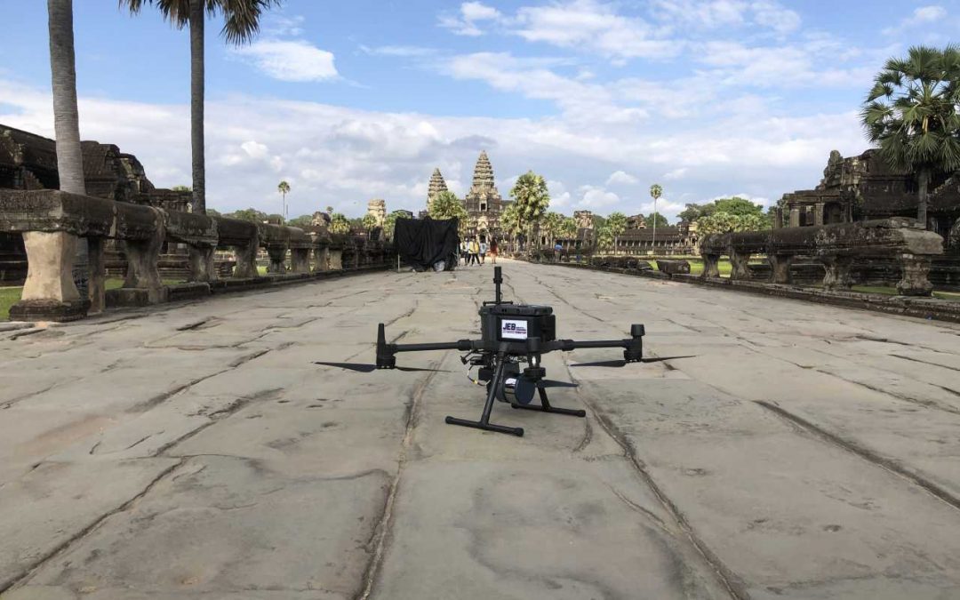
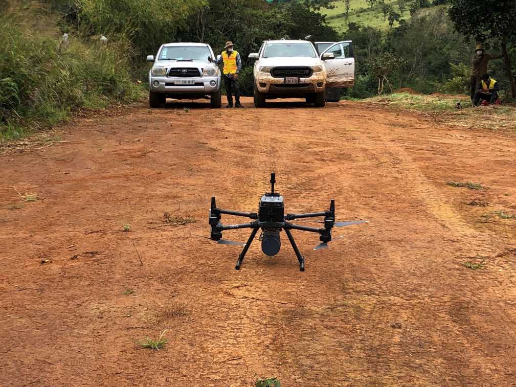
- DJI Matrice 300 RTK: Our multi-payload drone (swappable LiDAR and camera sensors). Can capture high-resolution images and video, photogrammetric data, and LiDAR data.
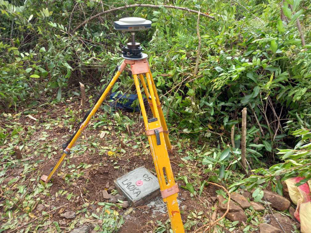
- Additional Equipment: DGPS base stations and rovers, digital levels, ground control points, and industry-leading data processing software.
What is the Survey Process?
- Communication: Good communication ensures all parties are clear on the project area, location, access requirements, and desired project output.
- Mobilization: The survey team briefs the project, prepares the equipment, and travels to the project location
- Implementation: Conduct the survey
- Data Processing and Mapping
- Quality Control: Senior engineers check the data and final output to ensure accurate data
- Final Delivery: Contains a report with fieldwork, methodology, data, and topographic maps. Deliverables vary depending on the project.
The timeframe for the full process depends on project variables such as the size of the site, site accessibility, and the complexity of the terrain. We estimate the time a particular project will take and agree upon it upfront ensuring that any deadlines are met.
Delays may occur. In those cases, we inform the client quickly and transparently with the reasons and the newly estimated timeline.
How Much Does Drone Surveying and Mapping Cost?
It is practically impossible to give an estimated price until we learn more about a project. Pricing for drone surveying and mapping largely depends on the time and complexity of the project.
What can be said is that no matter the size of the project, all of our clients are supplied with clear and quality deliverables that can be used as the basis for design, planning, and evaluation.